


Downtown Singapore is often seen from behind taxi windows and office glass, but its streets are best understood at walking pace. This self-guided route through Raffles Place, Lau Pa Sat, Telok Ayer and Tanjong Pagar turns the Central Business District into an open-air museum, revealing how a small river port became a global financial hub and how the waterfront itself has marched steadily seaward through two centuries of land reclamation.
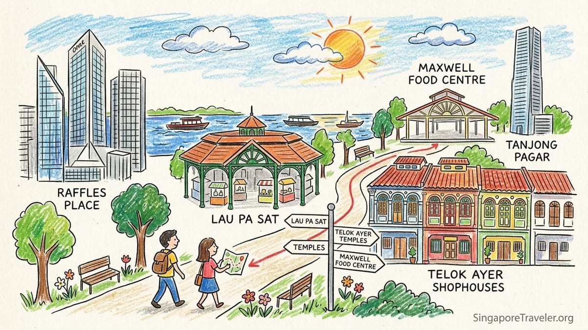
How This Self-Guided CBD Walk Works
This walking tour is designed as a flexible loop through the historic core of the Central Business District. It starts at Raffles Place MRT, traces the original riverfront and banking district, cuts across to Lau Pa Sat, then dives into the conserved shophouses and temples of Telok Ayer. From there, you can either finish a shorter version near Telok Ayer MRT or continue through Ann Siang, Maxwell Food Centre and Tanjong Pagar for a deeper look at how the old port area has been reshaped.
The shorter version, from Raffles Place to Telok Ayer, covers roughly 2 to 2.5 kilometres and takes about 1.5 to 2 hours at a gentle pace with photo stops and a coffee break. The longer version, which adds Ann Siang Hill, Maxwell area and Tanjong Pagar, is closer to 4 to 5 kilometres and works comfortably as a half-day wander of 3 to 4 hours including meals.
You will be on your feet in tropical heat and humidity, but this is the rare city walk that threads between air-conditioned malls, underground passages and shaded arcades. You can duck into Raffles Place’s underground linkways, Lau Pa Sat’s breezy interior and modern office lobbies whenever you need to cool down, and several recommended coffee bars and hawker centres along the way make it easy to rest and refuel.
This guide assumes you are starting in the late afternoon for softer light and to catch Lau Pa Sat’s satay street as it comes alive in the evening, but the route also works in the morning if you prefer cooler temperatures and quieter streets.
Raffles Place and the River: Birthplace of Commercial Singapore
Begin at Raffles Place MRT, exiting into the open plaza framed by office towers like One Raffles Place and Republic Plaza. It is easy to see only the glass and steel, yet this was once a low hill by the mouth of the Singapore River. In the 1820s, that hill was partly leveled and its soil used to reclaim the swampy riverbank, creating the firm ground that became Commercial Square, later renamed Raffles Place. Standing here, you are on one of Singapore’s earliest land reclamation projects, the original front door of the colony’s trading town.
Walk the short distance to the river edge at Boat Quay and look back at the skyline. In the 19th century, ships anchored just offshore and cargo moved into godowns along the river. Today you will see a tidy row of conserved shophouses with bars and seafood restaurants at Boat Quay’s edge, dwarfed by skyscrapers behind them. That contrast is the visual story of this walk: the early waterfront trade of spices, tin and rubber replaced by global finance and digital commerce, yet still physically anchored to the same narrow waterway.
As you circle back from the river to the main square, notice how banking still dominates the area. Major financial institutions occupy towers around the plaza, echoing the late 19th and early 20th centuries when British, Indian and Chinese banks clustered here to finance trade across the region. In less than ten minutes on foot you move from the embankment that made the first commercial waterfront possible to the towers that symbolise Singapore’s current role as a financial centre.
This first leg is short, around 1 kilometre including detours to the river, and mostly flat. If you need a break, step into the air-conditioned underground mall linked to the MRT or pause at one of the coffee chains around the square. Prices for a basic latte typically sit around the same range as major international chains, so you can budget accordingly.
Lau Pa Sat and Collyer Quay: Markets on Reclaimed Land
From Raffles Place, walk south along Malacca Street or through the covered walkways toward Lau Pa Sat. Within about 8 to 10 minutes, the skyline parts to reveal an octagonal pavilion of green-painted cast iron and terracotta tiles. This is Lau Pa Sat, originally Telok Ayer Market, completed in its current iron form in the 1890s. It once stood directly on the shoreline at the edge of the bay; today it is landlocked in the middle of office blocks, a clear sign of how much land has been added to Singapore’s southern coast.
Step inside for your first proper break. The interior is air-conditioned during the day and ringed with hawker stalls. Office workers flock here for lunch on weekdays, but you can usually find a table if you avoid the peak hour rush. Expect to pay moderate prices for staple dishes: a plate of chicken rice, a bowl of laksa or a serving of fried carrot cake typically falls in the single-digit Singapore dollar range, while bottled drinks and fresh juices cost a bit more. The combination of historic setting and everyday food culture makes Lau Pa Sat a good introduction to Singapore’s hawker scene.
Look up at the intricate roof structure while you eat. The cast-iron columns and trusses were prefabricated and shipped in pieces, a Victorian engineering solution to building in the tropics. Imagine, when this market opened, the sea lapped just beyond its edges and small boats brought in fresh produce straight from the harbour. The modern address, deep inland from the water, is the product of successive reclamation in front of Collyer Quay and the extension of the CBD towards what is now Marina Bay.
In the evening, the street on the Boon Tat Street side of Lau Pa Sat is partially closed and transformed into a satay strip. If your timing allows, returning here after your walk gives you a chance to eat grilled skewers under bare bulbs with the towers of Raffles Place glowing above. It is hectic, smoky and touristy, but also one of the most atmospheric ways to end a day in the CBD.
Telok Ayer: Old Shoreline of Temples and Clan Houses
From Lau Pa Sat, make your way northwest toward Telok Ayer Street. The walk takes about 10 minutes and passes abruptly from glass facades into a low-rise streetscape of conserved shophouses with traditional five-foot-ways. Telok Ayer means “water bay” in Malay, and until the late 19th century this narrow street marked the edge of the sea. Early Chinese immigrants landed here and, before searching for lodging or work, many made their way directly to small shrines along the shore to give thanks for safe passage.
That spiritual imprint remains visible. As you walk along Telok Ayer Street you will pass Thian Hock Keng Temple, one of Singapore’s oldest Chinese temples, dedicated to Mazu, the sea goddess. When it was first built, worshippers could look out from its entrance directly onto the waves. Today the temple sits more than a ten-minute walk from the nearest water, a measure of how land reclamation has pushed the waterfront outward in stages, first to Collyer Quay and later to Marina Bay.
Take time to step into Thian Hock Keng’s courtyard. Admission is usually free, although donations are welcome. Note the richly carved wooden doors, tiled roof ridges that curl upwards, and ceramic figurines along the eaves. These details speak to the wealth and aspirations of the Hokkien community that financed the temple, many of whom made their fortunes in the very commercial houses back at Raffles Place. Photography is often allowed in the outer courtyards, but be respectful and avoid flash during active prayer.
Spreading out around the temple are clan associations, churches and mosques, reflecting how Telok Ayer developed as a multi-ethnic landing district. A few doors away, you may find a South Indian Muslim mosque, while on a side street sits a Chinese clan house that still hosts community events. Between them, stylish cafes and bars occupy restored shophouses, serving specialty coffee and modern Asian menus to a mix of office workers and visitors. Coffee prices here often match those in other central neighbourhoods, but you are paying as much for the ambience of tiled floors, timber shutters and quiet courtyards as for the drink.
Short Route Option: Ending at Telok Ayer MRT
If you are short on time or visiting in the heat of the day, this is a natural point to conclude your walk. From Thian Hock Keng Temple, Telok Ayer MRT is only a few minutes away on foot. By this stage you will have covered roughly 2 to 2.5 kilometres: from the reclaimed hill of Raffles Place to the early market at Lau Pa Sat and the original shoreline at Telok Ayer. You will also have passed through at least three distinct eras of Singapore’s urban history, all within an easy compact loop.
Before you leave, consider one last drink or snack in the area. A traditional Chinese bakery might sell egg tarts and pastries from a small counter, while a modern juice bar next door offers cold-pressed mixes ideal for rehydration. Prices for a takeaway snack plus drink generally stay under a modest budget, making this an accessible stop even for cost-conscious travellers.
To backtrack efficiently, you can either return to Raffles Place MRT via the underground Downtown Line or walk 10 to 15 minutes across to your starting point. The streets between Telok Ayer and Raffles Place are laced with covered walkways and air-conditioned lobbies, so you can adjust your path to maximise shade and cool air. For many visitors, this condensed loop offers just enough walking to grasp how the commercial waterfront shifted from river edge to bayfront while still leaving energy for an evening elsewhere.
If, however, you want a fuller picture of the old docklands and a few more food stops, continue with the longer route into Ann Siang, Maxwell and Tanjong Pagar. This extension adds another 1.5 to 2.5 kilometres and opens up some of the most atmospheric streets in central Singapore.
Long Route: Ann Siang, Maxwell Food Centre and Tanjong Pagar
From Telok Ayer Street, turn towards Ann Siang Hill and Club Street. Within 5 to 10 minutes you are climbing a gentle slope lined with restored shophouses. Historically this was a residential enclave for wealthy Chinese merchants, close enough to the docks and banks for business yet elevated and breezier. Today, wine bars and restaurants occupy many of the same buildings, and in the evenings the area has a lively but compact nightlife scene. If you are walking by day, it is generally quiet and a pleasant contrast to the flat grid of the CBD below.
Continue towards South Bridge Road and head in the direction of Maxwell Food Centre. This low-rise hawker centre, sheltered under a simple roof with large fans, is one of the easiest places in downtown Singapore to sample local dishes at everyday prices. For a very approximate guide, a bowl of fish soup, a plate of chicken rice or a serving of fried noodles usually costs under ten Singapore dollars, though popular stalls may charge slightly more. Drinks from the stalls at the edge of the hall are typically the most affordable way to rehydrate, whether you choose lime juice, iced barley or a simple kopi peng, local iced coffee with milk.
Maxwell is a good place to take a longer break, especially between late morning and mid-afternoon when the office crowds thin out. Unlike Lau Pa Sat’s ironwork and skyline views, the appeal here lies in the everyday routine of lunch queues, laminated menus and shared plastic tables. Together they form a bridge between the older shophouse neighbourhoods around Chinatown and the office towers of Shenton Way and Tanjong Pagar next door.
From Maxwell, continue towards Tanjong Pagar Road. The name Tanjong Pagar refers to a “cape of stakes,” recalling the wooden stakes that once protected village fish traps along the shore. The area later became associated with docks and working-class housing. Today, you will find a mixture of conserved shophouses, modern residential towers and a dense grid of small streets. Look for the shophouse terraces running parallel to the main road, where you can still find traditional medical halls, barbers and household shops alongside cocktail bars and Korean barbecue restaurants.
Tracing the Moving Waterfront Through Reclamation
As you walk from Raffles Place to Tanjong Pagar, it can be hard to picture where the sea once stopped. To visualise it, imagine pausing at three points on your route. First, at the river edge near Boat Quay, you are close to the early 19th-century commercial heart, where boats brought cargo up the Singapore River and the earliest reclamation created firm ground for warehouses. Second, at Lau Pa Sat, you are standing roughly where the shoreline moved to in the late 19th century, once the bay had been partially filled and quays laid out. Third, at the edge of today’s Marina Bay, a few blocks further south from Lau Pa Sat, you reach the modern waterfront created by large-scale reclamation in the late 20th century.
Walking between these points in less than half an hour compresses more than a century of coastal engineering into a morning stroll. The distance from Telok Ayer Street to the water is now filled with office towers and transport links, but historically it was the open bay where ships lay at anchor. Similarly, the land between the old Collyer Quay and today’s Marina Bay promenade was once part of the harbour, later filled in to create an extension of the CBD with corporate towers and civic landmarks.
This gradual outward push of the shoreline changed not just the map but the life of each district. As the docks moved seaward and larger ports were built closer to the new waterfront, areas like Telok Ayer shifted from working shoreline to inland neighbourhood. Temples and clan houses that began as seaside shrines now find themselves woven into a dense city grid, their role evolving from life-and-death waypoints for new arrivals to heritage anchors and community spaces for residents and office workers.
Your walking tour becomes a way of reading those layers. At Raffles Place, think of soil from a hill used to claim land from a swamp. At Lau Pa Sat, imagine an iron market built almost on the water’s edge, now surrounded by asphalt and glass. In Telok Ayer and Tanjong Pagar, look for names and carvings that point to the sea even as the actual waves lie a good walk away. The changing waterfront is not an abstract planning story; it is visible in every curve of the shoreline you no longer see and every block of reclaimed ground under your feet.
Practical Tips: Air-Con Breaks, Heat Management and Safety
Singapore’s equatorial climate means you should expect high humidity and temperatures generally above 30 degrees Celsius during the day, with occasional sudden showers. Schedule the bulk of your walking for early morning or late afternoon if possible. The route described here can be completed comfortably between about 4 pm and 8 pm, combining daylight for photography at Raffles Place and Telok Ayer with an evening meal at Lau Pa Sat or Maxwell Food Centre.
Air-conditioned breaks are easy to build in. At Raffles Place, underground malls and MRT concourses offer cool air and clean restrooms. Lau Pa Sat’s interior is cooled and well ventilated. Around Telok Ayer, many cafes and small restaurants are air-conditioned; even a simple iced drink justifies a short rest in comfort. In Tanjong Pagar, shopping arcades and hotel lobbies dot the main road, giving you additional options if sudden rain arrives.
Footpaths in the CBD are generally well maintained, with frequent pedestrian crossings and clear curb cuts, but be prepared for occasional construction fencing and uneven surfaces near older shophouses. Comfortable walking shoes and light clothing are essential. Carry a small umbrella, both for sun and showers, and refill a reusable water bottle whenever you sit down to eat. Street crime rates are generally low, but standard city awareness still applies: keep valuables secure, watch for traffic when crossing smaller streets and be cautious of slick tiles after rain.
If you are travelling with young children or older relatives, consider splitting the route into segments. For example, one morning could focus only on Raffles Place, the riverfront and Lau Pa Sat, with another day reserved for Telok Ayer and Tanjong Pagar. Public transport links tie all sections together, so it is easy to abandon the walk if heat or storm clouds make continuing uncomfortable.
The Takeaway
This downtown walk shows that Singapore’s Central Business District is more than a cluster of towers. Raffles Place, Lau Pa Sat, Telok Ayer and Tanjong Pagar together tell a continuous story: from hilltop leveled for warehouses, to shoreline market and immigrant landing bay, to a dockside district reshaped into a dense mix of offices, shophouses and food centres.
Following this route on foot, you experience how the island’s commercial heart has always faced the water, even as that water has been pushed step by step away from its original line. You pass from early trading houses and Victorian iron markets to modern hawker centres and high-rise offices, with temples and clan houses anchoring each chapter along the way.
Whether you choose the shorter loop from Raffles Place to Telok Ayer or the full extension to Maxwell and Tanjong Pagar, the real reward is the sense of continuity. At street level, Singapore’s celebrated efficiency and modern skyline rest on layers of small shrines, shopfronts, markets and back lanes. Walking brings those layers to the surface, turning what might have been a quick business district photo stop into one of the most revealing half days you can spend in the city.
FAQ
Q1. How long does the full downtown Singapore walking tour take?
The longer route from Raffles Place through Lau Pa Sat, Telok Ayer, Ann Siang, Maxwell and Tanjong Pagar usually takes 3 to 4 hours at a relaxed pace, including food and photo stops.
Q2. How far is the walk from Raffles Place to Telok Ayer?
The shorter option from Raffles Place MRT to Telok Ayer, with a detour via Lau Pa Sat, covers roughly 2 to 2.5 kilometres and can be done comfortably in 1.5 to 2 hours.
Q3. Is this walking tour suitable in Singapore’s heat?
Yes, if you plan sensibly. Start in the cooler morning or late afternoon, move at an easy pace, use air-conditioned breaks in malls and cafes, and drink water regularly.
Q4. Are the temples and religious sites along Telok Ayer open to visitors?
Most major temples and religious buildings welcome visitors outside of major ceremonies, but opening hours can vary, so it is best to go during daylight and be respectful of worshippers.
Q5. How much should I budget for food on this route?
A modest budget per person can cover one substantial meal at Lau Pa Sat or Maxwell Food Centre plus drinks and one or two snacks from bakeries or cafes along the way.
Q6. Can I do this walk with children or older travellers?
Yes, but consider breaking it into shorter segments, building in more frequent breaks and using nearby MRT stations to shorten or skip sections if anyone gets tired.
Q7. Do I need a guide, or is it easy to follow on my own?
The route is straightforward to follow with basic map navigation, and signage around Raffles Place, Telok Ayer and Tanjong Pagar is clear, so most visitors manage well without a guided tour.
Q8. What should I wear for a CBD walking tour in Singapore?
Light, breathable clothing, comfortable walking shoes, a hat or cap and a small umbrella for both sun and rain are the most practical choices.
Q9. Is it safe to walk through downtown Singapore in the evening?
The central districts on this route are generally busy and feel safe into the evening, though you should still observe basic city precautions and stay aware of traffic and surroundings.
Q10. How does this walk differ from a Marina Bay waterfront stroll?
This route focuses on the historic commercial core, temples and shophouses behind the modern waterfront, while a Marina Bay walk is more about skyline views and the newest reclaimed shoreline.