


Singapore’s Downtown Core is dense, vertical and surprisingly walkable underground. For first-time visitors, the cluster of CBD MRT stations with similar names can be confusing. Pick the right one, though, and you can step almost directly into Lau Pa Sat, your Tanjong Pagar hotel lobby or the Marina Bay waterfront. This guide breaks down which station to use for specific attractions, how the lines connect, and when it is faster to walk between stops than to change trains.
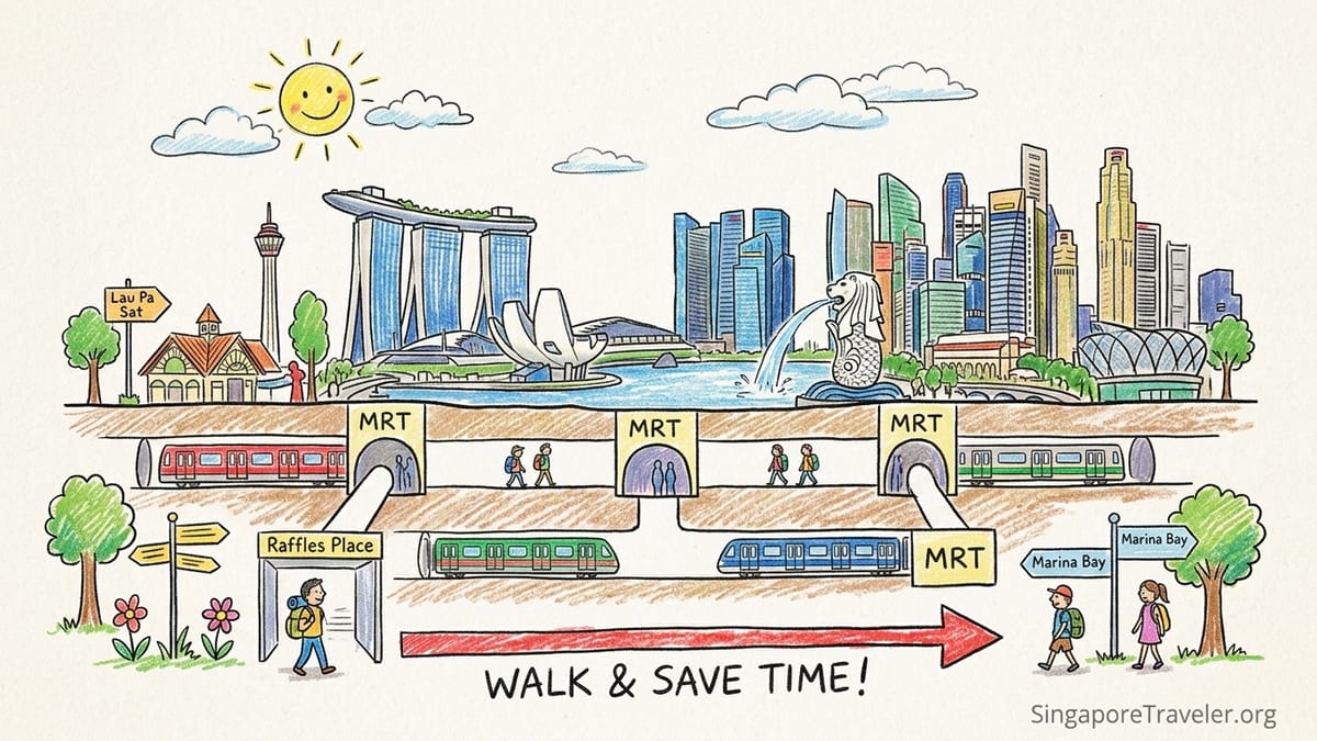
Understanding the Downtown Core MRT cluster
The Downtown Core is served by a tight web of MRT lines: the North South Line, East West Line, Downtown Line, Circle Line and Thomson East Coast Line. Within a radius of roughly 1 to 1.5 kilometres you will find Raffles Place, Downtown, Shenton Way, Telok Ayer, Tanjong Pagar, Marina Bay and City Hall stations. Many are within a 5 to 10 minute walk of each other at street level or via air-conditioned underground links through office towers and malls.
On the map these stations look separate, but in practice they function as one large transport hub for the CBD. For example, Raffles Place sits on the North South and East West Lines, while Downtown is on the Downtown Line and Shenton Way on the Thomson East Coast Line. Marina Bay is a major three-line interchange for the North South, Circle and Thomson East Coast lines. City Hall is another North South and East West interchange just one stop from Raffles Place. For visitors staying in the CBD, you will often have two or three viable station choices for a given sight or hotel.
Because of this overlap, route planners sometimes recommend extra interchanges that are not worth the time. As a rule of thumb, once you are within one or two stops of the Downtown Core, it is often quicker to ride to the first convenient station, tap out and walk to your final destination, especially off-peak. For example, walking from Raffles Place to Downtown or from Tanjong Pagar to Shenton Way usually takes around 8 to 12 minutes, comparable to making one more line change and waiting for a connection.
The stations also differ in feel and crowd levels. Raffles Place and City Hall are some of the busiest commuter interchanges in Singapore during weekday rush hours, while Telok Ayer and Shenton Way feel calmer and more local. Marina Bay can be busy at peak commuting times but quieter at night and on weekends, when many office towers empty out. Knowing this helps you decide not only which station is closest, but which one offers the easiest experience with luggage or kids in tow.
Raffles Place: the CBD’s classic interchange for Boat Quay and Lau Pa Sat
Raffles Place is the historic heart of the financial district and one of Singapore’s key MRT nodes. It is an underground interchange between the North South Line and East West Line, with cross-platform transfers that make changing lines especially easy. Trains here run frequently in both directions, and the station has around ten entrances spread under and around office towers such as Republic Plaza, CIMB Plaza and Six Battery Road. In practice this means you can emerge very close to the river, Boat Quay or major bank offices simply by picking the right exit.
For the Singapore River and Boat Quay, aim for exits on the riverside side of the station. From there, it is a short 3 to 5 minute walk to rows of waterfront restaurants and bars. Many travelers staying elsewhere in the city still use Raffles Place as their gateway to evening drinks along the river because the route is simple: follow signs to the river exits, then walk straight until you see the water. Similarly, if you are heading for the Fullerton Hotel or the Merlion Park waterfront, Raffles Place is a convenient access point, with a 10 minute walk past the neo-classical Fullerton building.
Lau Pa Sat, one of Singapore’s most famous food courts, is also best reached from Raffles Place. From the station concourse, follow the signs for the exits leading toward Raffles Quay and Telok Ayer Street. At street level, the cast-iron structure of Lau Pa Sat is about 5 to 7 minutes on foot, slightly inland from the waterfront. In the evening, Boon Tat Street beside the market transforms into a popular satay street, and many office workers walk over directly from Raffles Place after work. Although Downtown and Telok Ayer stations are technically closer on the map, Raffles Place is often the more straightforward option if you are already on the North South or East West Line.
Be prepared, however, for crowds at Raffles Place on weekdays roughly between 8 am and 9.30 am and again from about 5.30 pm to 7 pm. Trains can arrive packed and platforms get busy with office workers transferring between lines. If you are traveling with bulky luggage or small children during these times, consider alighting one station earlier or later, at City Hall or Tanjong Pagar, and walking the remaining distance. Outside peak commuting hours, Raffles Place is efficient and well signposted, and its central position makes it the first choice for many CBD destinations.
Downtown and Telok Ayer: best for Lau Pa Sat, Marina Bay Link Mall and local streets
Downtown station, on the Downtown Line, sits at the base of the Marina Bay Financial Centre towers and is directly connected to several large office complexes, including Asia Square and Marina Bay Link Mall. For travelers staying in or visiting newer mixed-use developments like Marina One Residences or the premium office towers by the bay, Downtown is usually the closest stop. From the station’s multiple exits you can walk indoors through air-conditioned corridors into offices, retail and food courts, which is particularly welcome in midday heat or tropical downpours.
For the Marina Bay waterfront promenade in front of the financial centre, Downtown is also very convenient. From the appropriate exit, it is about a 5 to 8 minute walk through Marina Bay Link Mall or around the towers to reach the promenade with its views across to Marina Bay Sands. Many visitors arrive here late afternoon, walk the bay in a loop and then either continue on foot toward Boat Quay and Raffles Place or ride one station to Marina Bay for onward connections. Because Downtown is on the Downtown Line, it is the natural choice for those coming from Bugis, Little India, Chinatown or the hotel clusters along the blue line.
Telok Ayer station, also on the Downtown Line, lies just to the west under Telok Ayer Street. It is a compact, quieter station that gives direct access to heritage shophouses, small cafes, temples and narrow side streets. If you want to explore Telok Ayer’s cafe scene or visit Thian Hock Keng Temple and the surrounding streets, this stop puts you within a 2 to 5 minute walk. For Lau Pa Sat, Telok Ayer is often the single most convenient station; from certain exits you can reach the hawker centre in roughly 4 to 6 minutes on foot along local streets without crossing major junctions.
In practice, Downtown and Telok Ayer are so close to each other and to Raffles Place that you can often choose based on where you are coming from. If you are already on the Downtown Line, use Downtown or Telok Ayer directly. If you are on the North South or East West lines, it is usually easier to ride to Raffles Place and walk to Lau Pa Sat or Marina Bay Link Mall rather than making a transfer. Walking between Downtown and Raffles Place can take roughly 10 minutes through office towers and underground linkways, which is comparable to train frequencies and interchange times at peak hours.
Shenton Way and Tanjong Pagar: for business hotels and the southern CBD
Shenton Way station is on the Thomson East Coast Line and serves the southern edge of the CBD near Shenton Way and Prince Edward Road. It opened as part of the newer brown line, giving direct connections from areas such as Orchard Boulevard and the eastern residential districts straight into the business core. The station’s exits open into and around office buildings and newer residential towers, making it convenient for those working or staying in this part of town. Because it is still less familiar to tourists, platforms and exits here can feel less hectic than Raffles Place at peak times.
Tanjong Pagar station, one stop from Raffles Place on the East West Line, anchors another cluster of business hotels, serviced apartments and eateries. Hotels such as the Oasia Hotel Downtown, Carlton City Hotel, Amara Singapore and M Hotel are all within roughly 5 to 10 minutes’ walk of Tanjong Pagar station, making this area attractive for visitors who want CBD convenience without being right under the busiest towers. Robinson Road, Anson Road and Tras Street are all easily reached from the station’s multiple exits, with many local coffee shops and Korean eateries nearby.
If your hotel reservation mentions “Tanjong Pagar” or lists an address on Anson Road, Gopeng Street or Tras Street, Tanjong Pagar station is almost always the one you should aim for. From Changi Airport, that usually means taking the East West Line and staying on until Tanjong Pagar, avoiding any need to change lines in the CBD. For meetings in the southern part of Shenton Way, you can choose either Tanjong Pagar on the East West Line or Shenton Way on the Thomson East Coast Line depending on where you are coming from.
Walking between Shenton Way and Tanjong Pagar is straightforward and typically takes around 8 to 10 minutes along Robinson Road or Shenton Way. Many office workers do this daily instead of transferring between lines underground. For example, if you come from Orchard on the Thomson East Coast Line and are staying at a Tanjong Pagar hotel, you might alight at Shenton Way and walk to your hotel rather than change to the East West Line. Similarly, if you arrive on the East West Line but have a meeting near the newer Thomson East Coast Line offices, you can often walk south from Tanjong Pagar rather than riding one stop and changing lines.
Marina Bay and City Hall: waterfront promenades, museums and big-name hotels
Marina Bay station has grown into one of Singapore’s most important interchanges, bringing together the North South Line, Circle Line and Thomson East Coast Line. It sits at the southern end of Marina Bay, close to Marina Bay Financial Centre and Marina One but slightly further from Marina Bay Sands than Bayfront station. For travelers staying at hotels in or around the financial centre towers or Marina One Residences, Marina Bay is sometimes the most direct choice, especially if you arrive on the Circle Line or Thomson East Coast Line from HarbourFront, Orchard or the east.
For the Marina Bay waterfront itself, especially the section near the financial centre and the Marina Bay City Gallery, Marina Bay station is a good starting point. From the appropriate exit, you can reach the waterfront promenade in about 5 to 10 minutes, with sweeping views of the bay and skyline. From there many visitors walk in a loop via the Helix Bridge, Marina Bay Sands and the ArtScience Museum before circling back on the opposite side toward Boat Quay and Raffles Place. If you are planning that full loop, it is often worth checking where you will end up and choosing your entry station accordingly. For example, you might start at Marina Bay and finish near City Hall or Raffles Place, walking through the CBD rather than riding one stop on the train.
City Hall station, on the North South and East West Lines, is the natural MRT gateway to Singapore’s civic district, museums and several high-profile hotels. It sits beneath the Raffles City shopping complex and is linked by underground passages to malls such as CityLink and to nearby hotels like Fairmont Singapore and Swissotel The Stamford. From City Hall, you can walk in around 5 to 10 minutes to the National Gallery Singapore, which occupies the former Supreme Court and City Hall buildings, as well as the Asian Civilisations Museum on the riverfront and the Padang lawn.
For travelers focused on museums or staying at hotels such as Raffles Hotel, Grand Park City Hall or the heritage properties in the civic district, City Hall is almost always the right choice. It avoids the heavy commuter flows at Raffles Place during rush hour and places you within easy walking distance of historic churches, colonial buildings and green spaces. From City Hall you can also walk to the Singapore River and Boat Quay in roughly 10 to 15 minutes. Many visitors choose to arrive at City Hall in the morning for museum visits, then walk along the river to Raffles Place or Clarke Quay later in the day rather than making short MRT hops.
When walking beats changing trains in the CBD
The greatest mistake many first-time visitors make in Downtown Singapore is overusing interchanges for very short distances. Because the CBD stations are so close together, changing trains can easily add 10 to 15 minutes of walking along platforms, riding escalators and waiting for another train, only to cover what would have been an 8 to 12 minute stroll on the surface. In good weather, walking is often the more pleasant option, and even in the heat many routes offer shade from towers or covered walkways.
Raffles Place to Downtown is a clear example. While it is technically possible to ride from Raffles Place to Marina Bay on the North South Line and then change to another line, most office workers simply walk between Raffles Place and Downtown through One Raffles Quay and surrounding buildings. Similarly, the short hop between Raffles Place and Tanjong Pagar on the East West Line covers a district that is fully walkable; if you tap out at one and walk to the other, you often arrive faster than returning to the platform and waiting for the next train.
Another common situation arises around City Hall and Raffles Place. They are consecutive stations on both the North South and East West Lines, separated by roughly a kilometer at most. If you are visiting the National Gallery near City Hall but later have dinner at Boat Quay, it is typically easiest to exit at City Hall for the museum, then walk along the river toward Boat Quay and Raffles Place. Making two short MRT rides is possible but adds time for relatively little gain. The same logic applies if you are staying at a Tanjong Pagar hotel but have a riverside meeting near Raffles Place; walking north along Robinson Road or the back streets can be faster than relying on the single-stop ride.
There are practical limits, of course. In the heaviest midday heat or during tropical downpours, you may prefer to stay underground and make an extra transfer. Fortunately, many of the CBD stations are linked by underground passages through malls and basements, so you can still “walk” between areas without being outdoors for long. For example, you can walk from City Hall through CityLink Mall and under parts of the civic district, or from Raffles Place through commercial basements toward Downtown. Maps inside the stations show these connections, and many office workers rely on them daily during the wet season.
Managing peak hour crowds and choosing the right station
While the CBD network is efficient, crowd patterns vary by station and time of day. Raffles Place and City Hall are the classic examples of very busy interchanges during weekday peak periods. Between about 8 am and 9.30 am and again from roughly 5.30 pm to 7 pm, trains on the North South and East West lines can arrive almost full, and platforms at these two stations fill quickly with transferring passengers. Narrower escalators and concourses can create bottlenecks, which is noticeable if you are unfamiliar with the station layout or carrying luggage.
In contrast, stations like Telok Ayer and Shenton Way, while busy, often feel less frantic because they serve more localized office clusters rather than being major transfer points. Downtown and Marina Bay fall somewhere in between: they can be crowded at office start and end times, but conditions are usually more manageable outside those peaks. If you have flexibility, planning your journeys outside the classic commuter windows will make a noticeable difference, especially at Raffles Place.
For travelers with large suitcases or small children, a practical strategy is to favor origin or destination stations where you can board trains slightly earlier in their journey or where platforms tend to be less congested. For example, if you are staying at a Tanjong Pagar hotel and heading to the airport in the morning, boarding the East West Line there may be more comfortable than first going one stop to Raffles Place to transfer. Similarly, if you are heading to the Marina Bay waterfront from Orchard or the north on the Thomson East Coast Line, you might prefer to ride directly to Shenton Way or Marina Bay and walk along the promenade from there, rather than changing to another line at Raffles Place.
The key is to think in terms of districts rather than individual stations. Raffles Place and Boat Quay form one zone, Downtown and Marina Bay Financial Centre another, Tanjong Pagar and Shenton Way a third, and City Hall and the civic district a fourth. Once you know which zone your hotel or attraction sits in, you can choose the station that offers the most direct ride with the fewest interchanges, then finish the journey on foot. This approach mirrors how local commuters move around the CBD and can save you both time and stress.
The Takeaway
Navigating Downtown Singapore by MRT can look complex on the map, but on the ground the Downtown Core stations effectively blend into one large, walkable transport zone. Raffles Place stands out as the classic North South and East West interchange for Boat Quay, the Singapore River and easy access to Lau Pa Sat, but it is also the most crowded during commuter peaks. Downtown and Telok Ayer give seamless access to Marina Bay Financial Centre, Marina Bay Link Mall and the heritage streets around Telok Ayer, often with shorter walks and calmer platforms.
Further south, Tanjong Pagar and Shenton Way are ideal for business hotels and offices, while Marina Bay and City Hall anchor the waterfront promenades, civic district and flagship museums. Understanding how close these stations sit to one another makes it clear that walking between them often beats changing trains. With a mental map of which station serves which cluster of attractions, you can step off the train almost at your hotel lobby or riverside cafe, and enjoy more of the city instead of waiting on platforms.
FAQ
Q1. Which MRT station is best for visiting Lau Pa Sat?
The most convenient stations for Lau Pa Sat are Telok Ayer and Downtown on the Downtown Line, or Raffles Place on the North South and East West lines if you are already on those routes. From any of these, the walk typically takes under 10 minutes.
Q2. What station should I use for the Marina Bay waterfront promenade?
For the section near Marina Bay Financial Centre and Marina Bay City Gallery, use Downtown or Marina Bay. If you plan to visit Marina Bay Sands and the Helix Bridge, Bayfront station is usually more convenient, although you can still walk from Marina Bay in about 15 to 25 minutes depending on your route.
Q3. Which MRT stop is closest to Boat Quay and the Singapore River?
Raffles Place is the most direct station for Boat Quay, with a short walk from riverside exits. City Hall is also a reasonable choice if you are visiting museums first and then walking along the river toward Boat Quay.
Q4. Where should I get off for Tanjong Pagar business hotels?
If your hotel names Tanjong Pagar or lists a nearby street such as Anson Road or Tras Street, alight at Tanjong Pagar station on the East West Line. Hotels like Carlton City Hotel, Oasia Hotel Downtown and Amara Singapore are typically within a 5 to 10 minute walk.
Q5. Is it faster to walk between Raffles Place and Downtown than to change trains?
In many cases, yes. Walking between Raffles Place and Downtown usually takes about 10 minutes via office buildings and linkways, which is comparable to the time needed for an additional interchange and short train ride.
Q6. Which station should I use for the National Gallery and nearby museums?
City Hall is the most convenient station for the National Gallery Singapore, the Padang and the civic district. From there, you can also walk to the Asian Civilisations Museum and the riverside in roughly 10 to 15 minutes.
Q7. How crowded does Raffles Place get at rush hour?
Raffles Place can be very busy on weekdays between about 8 am and 9.30 am and again from roughly 5.30 pm to 7 pm, with packed trains and crowded platforms due to heavy transfers between the North South and East West lines.
Q8. Should I avoid interchanging at Raffles Place if I have luggage?
If you are traveling with large suitcases or children, it can be more comfortable to stay on a single line to a slightly less crowded station, such as Tanjong Pagar or City Hall, and then walk to your destination instead of interchanging at Raffles Place during peak times.
Q9. Are the CBD MRT stations within easy walking distance of each other?
Yes. Stations like Raffles Place, Downtown, Telok Ayer, Tanjong Pagar, Shenton Way, Marina Bay and City Hall are mostly within a 5 to 15 minute walk of one another, often connected by covered walkways or underground passages.
Q10. Which station is best for travelers staying in Marina Bay Financial Centre?
Downtown and Marina Bay stations both serve Marina Bay Financial Centre. Downtown is particularly convenient for accessing office towers and Marina Bay Link Mall directly via underground links, while Marina Bay offers additional connections on the North South and Circle lines.