


The Singapore River is one of the easiest places in the city to turn a half-day into a rich mix of history, skyline views and riverfront dining. This practical self-guided route follows the river downstream from relaxed Robertson Quay through lively Clarke Quay and Boat Quay, into the historic Civic District and finally Merlion Park, with an optional continuation around Marina Bay. Distances are short, paths are paved and mostly flat, and there are frequent options to duck into air conditioning or hop on the MRT if the tropical heat or a passing storm rolls in.
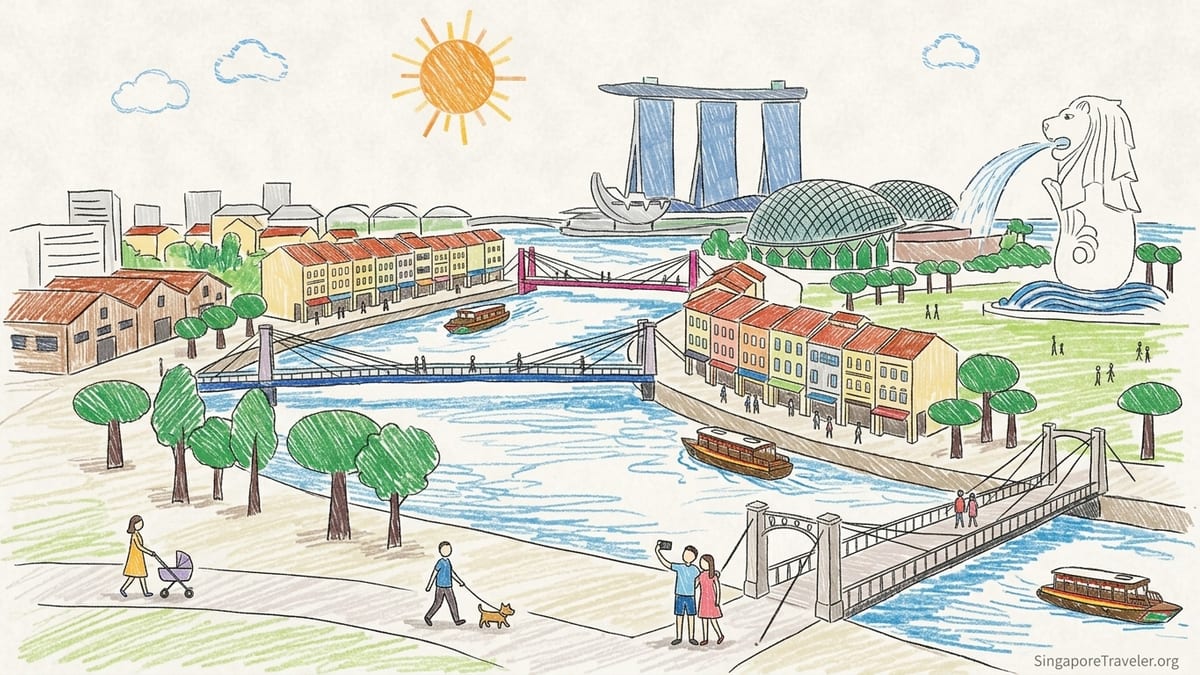
How this Singapore River walk works
This route runs roughly 2.5 to 3 kilometres from Robertson Quay to Merlion Park, plus another 1.5 to 2 kilometres if you continue around Marina Bay. Walking the core river section at an easy pace with photo stops takes about 1.5 to 2 hours; adding the bay loop turns it into a relaxed half day. The paths on both banks are well lit and usable day and night, though the feel shifts from calm in the morning to buzzy in the evening when the bars and restaurants fill.
There is no single “correct” bank to follow. The Singapore River is criss-crossed with a series of pedestrian-friendly bridges, from simple crossings like Jiak Kim Bridge at Robertson Quay to heritage structures such as Read Bridge at Clarke Quay and Cavenagh Bridge near the Civic District. A simple rule of thumb is to cross whenever you see a better angle on the skyline, a shadier path or a cluster of cafes that catches your eye. All distances and walking times here are approximate and based on a comfortable sightseeing pace.
Official tourism material and local precinct guides actively encourage walking between the three historic quays, noting that the riverside is porous and connected by underpasses and bridges along both banks. In practice that means you can start or end almost anywhere: Great World MRT for Robertson Quay, Clarke Quay MRT for the mid-river nightlife stretch, or Raffles Place and City Hall MRT for the Civic District and Merlion Park. This guide assumes you begin upstream at Robertson Quay and walk downstream towards Marina Bay.
The route is fully paved, stroller-friendly and mostly step-free, though some older bridges have short flights of stairs. There are frequent benches and ledges to sit on, and you are almost never more than a few minutes from a convenience store, mall or MRT station where you can cool down. Bring water, a hat and sunscreen, and consider an umbrella that can double as both sunshade and rain cover.
Stage 1: Robertson Quay’s relaxed riverside (start to 25 minutes)
Robertson Quay is the most upstream and laid-back of the three historic quays, with a mix of residential blocks, boutique hotels and low-rise warehouse conversions lining both banks of the river. It is easy to reach via Havelock or Great World MRT stations, each about a 10-minute walk away through shaded streets. From the river level near Jiak Kim Bridge, you immediately get a sense of how the old trading wharf has been reimagined into a lifestyle district, with joggers, dog walkers and outdoor tables spilling towards the water in the mornings and evenings.
A good starting landmark is the cluster around The Quayside and the warehouses opposite. From here, walk downstream on either bank towards Clarke Quay. The upstream section is especially pleasant just after sunrise or around 5 to 7 pm, when the light softens and the concrete reflects pastel colours. Cafes like Toby’s Estate or Common Man Coffee Roasters typically open in the morning and are popular with both locals and visitors. Expect coffee prices similar to international standards, with a flat white often in the range you would see at large global chains and generous brunch plates that easily serve as fuel for the walk ahead.
Architecturally, Robertson Quay offers sweeping riverside curves rather than single blockbuster buildings. This is a good place for wide-angle snapshots of the river corridor, reflections in the water and candid everyday scenes. If you only have time or energy for part of the walk, you could simply stroll this section as a riverside loop, crossing via Jiak Kim Bridge or Alkaff Bridge and returning to your starting bank, then heading back to the MRT or your hotel.
From a safety and comfort perspective this section is straightforward: wide promenades, clear sightlines and mixed residential and dining uses keep it feeling lively but not crowded. Public toilets are available in nearby malls and hotels that open onto the river; most visitors simply duck into a cafe, order a drink and use the facilities before continuing. From the mid-point of Robertson Quay, it takes roughly 20 to 25 minutes of easy walking to reach central Clarke Quay.
Stage 2: Bridges and bar life at Clarke Quay (25 to 45 minutes)
As you round the bend from Robertson Quay, the buildings begin to crowd closer to the river, and soon you reach Clarke Quay’s distinctive low-rise shophouses and colourfully roofed entertainment complex. Historically, this was a busy stretch of godowns and warehouses serving the river trade; today it is known for dining, bars and nightlife, particularly after sunset. The mood shifts markedly from Robertson’s residential calm to Clarke Quay’s animated energy.
This is the first section where bridge choice really influences your experience. Read Bridge is a key crossing here, often used as an informal gathering and photo spot, with views in both directions that take in the shophouse facades, riverboats and high-rise skyline behind. A little further downstream, Coleman Bridge gives a fine perspective back towards Clarke Quay, especially in the blue hour just after sunset when the neon signs and ambient lighting begin to glow. It is worth crossing at least once between these two bridges to vary your vantage points.
Food and drink options here are wide-ranging. International visitors gravitate towards riverfront restaurants offering everything from local chilli crab and satay to Italian and Japanese menus, usually at prices comparable to other prime tourist waterfronts in major cities. For a more local feel and lower prices, pop a block or two inland towards Hong Lim or Chinatown, where hawker centres and small eateries offer inexpensive dishes like Hainanese chicken rice or laksa. Clarke Quay MRT station sits just behind the main complex, so at this point you can easily shorten the walk: ride one stop to Raffles Place for quick access to Boat Quay and Merlion Park, or two stops to City Hall for the Civic District.
Photography-wise, Clarke Quay rewards patience. By day, focus on the contrast between heritage shophouses and contemporary towers. By night, slower shutter speeds or smartphone night modes can capture the interplay of coloured lights on the water and the movement of the river cruise boats. Be aware that tripods may not be practical on crowded sections of the promenade in the evening; handheld shots or compact travel tripods are usually easier to manage.
Stage 3: Historic shophouses at Boat Quay (45 to 70 minutes)
Continuing downstream, the river straightens and the skyline opens up as you enter Boat Quay. Historically this was the commercial heart of the Singapore River, with a dense line of shophouses on the southern bank where boats once unloaded cargo to be hauled into godowns. Many of those narrow-fronted buildings survive, painted in pastel colours and capped with characteristic red-tiled roofs, now housing restaurants, pubs and small offices.
For most walkers the more atmospheric route is to follow the southern bank along the shophouses, but the northern bank offers excellent photographic angles back across the river, with the shophouse roofline framed by glass and steel towers behind. Elgin Bridge is a useful crossing point here, with a classic perspective towards the Civic District and skyline. This is also a comfortable place to pause for river photos, as the sidewalks are slightly broader than at some other bridges and the traffic noise is manageable.
Boat Quay is a good mid-route pause for a drink or simple meal. Riverfront seafood restaurants tout set menus for dishes like chilli crab and black pepper crab; prices are generally higher than in neighbourhood eateries due to the prime location, so it is sensible to check menu boards before sitting down. For more casual options, look for cafes or bars offering happy-hour deals on draft beer and simple bar snacks in the late afternoon and early evening, or head inland to nearby streets where local-style eateries serve rice and noodle dishes at more modest prices.
If heat or rain intensifies at this point, Raffles Place MRT is a useful escape hatch. Entrances are only a few minutes’ walk from both banks. From here you can ride the train under the river and emerge at City Hall or Marina Bay, or call it a day and head back to your accommodation. Otherwise, continue on foot as the route tips from the quays into the institutional grandeur of the Civic District.
Stage 4: Civic District landmarks and green space (70 to 100 minutes)
Just beyond Boat Quay, the character of the riverfront changes again as you reach the Civic District. Here the focus shifts from shophouses and nightlife to grand public buildings and open lawns. On the north bank stands the Asian Civilisations Museum in the former Empress Place Building, and nearby the statue of Sir Stamford Raffles marks a key historic site near the river’s original shoreline. The north bank promenade is broad, landscaped and ideal for a slower, more contemplative stretch of the walk.
A short distance inland lies the Padang, one of Singapore’s earliest planned public open spaces and the scene of many major national events. Framing it are the National Gallery Singapore, housed in the linked former Supreme Court and City Hall buildings, and other civic landmarks such as the Victoria Theatre and Concert Hall. It is easy to make a short detour from the river, cutting through tree-lined Esplanade Park and looping back via Anderson Bridge or Cavenagh Bridge, both historic crossings with photogenic metalwork and river-level views.
This is an excellent area to factor in an air-conditioned break, particularly in the middle of the day. Museums such as the National Gallery typically open from late morning to early evening and offer cafe spaces as well as exhibitions. Admission fees vary, with discounts for residents and concessions; even if you do not commit to a full museum visit, spending 20 to 30 minutes in a lobby cafe can be a welcome respite from the humidity. Around lunchtime on weekdays, you will see local office workers sharing the space with visitors, giving the area a lived-in feel rather than a purely staged historic quarter.
For travellers wanting to shorten the route here, City Hall MRT station sits beneath a major mall complex just behind the Padang, and is one of the best-connected interchanges in central Singapore. From this point you are within a 10 to 15-minute walk of nearly every landmark mentioned in this section, including the riverfront promenades, so it works equally well as a starting or ending point for the Civic District portion of the walk.
Stage 5: Merlion Park and Singapore’s postcard skyline (100 to 120 minutes)
From the Civic District riverfront, follow the promenade downstream towards the distinctive outline of the Fullerton Hotel, a former General Post Office transformed into a luxury hotel. This stretch, between Cavenagh Bridge and Anderson Bridge, is one of the most photographed parts of the river corridor, as it frames both the historic lighthouse-like corners of the Fullerton building and the towers of the central business district. Look out for sculptural installations and small plaques that reveal layers of history and art woven into the landscape.
To reach Merlion Park, continue across or under the main road towards the bay. The path threads past or beneath traffic, re-emerging at the water’s edge in front of the Merlion statue, the half-lion, half-fish creature that has become an informal symbol of Singapore. From here, you have the classic view across Marina Bay to Marina Bay Sands, the ArtScience Museum and the double-helix bridge in the distance, as well as back towards the financial district towers. This is one of the busiest photography points in the city, particularly at sunset and in the early evening when the skyline lights come on.
The area immediately around the Merlion can be hot and exposed mid-day, with limited natural shade. There are, however, benches, low walls for short rests and a few nearby cafes and mall food courts where you can cool off. If a thunderstorm blows in, many visitors simply shelter under nearby building overhangs or in the mall arcades until the downpour eases, which often happens within 30 to 60 minutes in the wet season.
From Merlion Park, Raffles Place MRT and Esplanade MRT are both within a 10 to 15-minute walk, offering quick exits in multiple directions. Taxis and ride-hail cars are usually easy to find on surrounding roads, though pick-up points may require short signed walks through adjacent mall complexes due to traffic management around the bay.
Optional continuation: Looping Marina Bay
If you still have energy and the weather cooperates, consider extending the walk around Marina Bay from Merlion Park. The simplest loop heads from the Merlion along the waterfront towards the Esplanade Theatres with their spiky domes, crosses the Jubilee Bridge or nearby pedestrian pathways, and continues around towards the Helix Bridge and Marina Bay Sands. This adds roughly 30 to 45 minutes of walking, more if you stop frequently for photos or to go inside attractions.
Along this loop you enjoy some of the most expansive skyline views in Singapore. In the late afternoon and evening, reflections on the bay can be striking, and the wide promenades accommodate both casual strollers and joggers without feeling too crowded except on major event nights. Occasional public art pieces and temporary installations often line the route, especially during festivals and light shows, so allow time to explore diversions that catch your eye.
Food and drink options proliferate along this stretch, from small kiosks selling bottled water and ice cream to full-service restaurants and rooftop bars with views back towards the river mouth. Expect prices to climb as the view improves. If you are travelling on a tighter budget, it can be smarter to have your main meal earlier in the walk at or near the quays, then treat this section as a post-dinner stroll with perhaps a single drink or dessert stop.
Transport shortcuts remain close at hand. Bayfront MRT beneath Marina Bay Sands connects you back into the network, while Esplanade and Promenade stations serve the opposite side of the bay. In practical terms that means you can peel off the loop at several points if fatigue, weather or time constraints catch up with you, without ever feeling stranded.
Practical tips: Heat, rain, timing and safety
Singapore’s tropical climate shapes how pleasant this walk will feel. Midday sun can be intense year-round, with temperatures often in the low thirties Celsius and humidity making it feel hotter. Whenever possible, aim to start shortly after sunrise or in the late afternoon. An early-morning walk from Robertson Quay catches the riverfront at its quietest and coolest, while a late-afternoon start timed to arrive at Merlion Park around sunset offers dramatic lighting on the skyline and more comfortable temperatures.
Sudden showers are common, especially during the wetter months, but the urban setting makes this route resilient to rain. You are usually within a few minutes’ dash of shelter under a bridge, in a mall arcade or inside a cafe. A compact umbrella that fits in a day bag is more practical than a rain jacket in the humidity, and it doubles as sunshade when the clouds clear. Surfaces along the riverfront are generally well maintained but can become slippery when soaked, so take extra care on slopes and metal bridge decks after rain.
Safety is straightforward: the entire route is in a busy central area with good lighting, CCTV coverage and a regular presence of joggers, office workers and other visitors even into the evening. Normal city precautions apply. Keep valuables zipped away, be aware of e-scooters or bicycles using certain paths and watch for steps at bridge approaches. Tap water in Singapore is potable, so refilling a reusable bottle in mall restrooms or fountains where available can help manage both cost and plastic waste.
Finally, remember that although distances are short, the combination of heat, sightseeing stops and photo breaks can make the walk more tiring than it looks on a map. Build in time to linger at places that interest you, whether that is pausing for a kopi at a local-style coffee shop near Boat Quay or spending an extra hour inside a museum in the Civic District. The beauty of this route is its flexibility: you can treat it as a brisk walk linking viewpoints or as a gentle thread connecting a series of independent stops.
FAQ
Q1. How long does it take to walk from Robertson Quay to Merlion Park at a relaxed pace?
Most visitors should allow about 1.5 to 2 hours for the core walk, including brief photo stops and a drink break, without entering museums or detouring around Marina Bay.
Q2. Is it better to walk this route in the day or at night?
Both have appeal. Early mornings are cooler and quieter, while late afternoon into evening offers dramatic skyline lighting and more atmosphere at Clarke Quay and Boat Quay.
Q3. Can I do this walk with young children or a stroller?
Yes. The route is mostly flat, paved and step-free, aside from some older bridges that have short stair sections. You can always stay on one bank and avoid stairs if needed.
Q4. What should I wear and bring for this Singapore River walk?
Light, breathable clothing, comfortable walking shoes, a hat, sunscreen and a compact umbrella are advisable. A reusable water bottle is useful, as tap water is safe to drink.
Q5. Are there public toilets along the way?
Dedicated public toilets on the promenade are limited, but you are rarely far from mall complexes, museums, cafes and restaurants where facilities are available for customers.
Q6. How can I shorten the walk if it gets too hot or starts raining?
Key MRT exits along or near the route include Great World or Havelock for Robertson Quay, Clarke Quay for mid-river, Raffles Place for Boat Quay and Merlion, and City Hall for the Civic District.
Q7. Is the Singapore River walk safe for solo travellers at night?
The area is generally busy, well lit and feels safe into the evening, with many locals jogging or dining. Normal city precautions with valuables and awareness of surroundings still apply.
Q8. Where are the best photography spots on this route?
Popular spots include Read Bridge at Clarke Quay, Elgin Bridge over Boat Quay, Cavenagh Bridge near the Civic District, and Merlion Park for skyline and Marina Bay views.
Q9. Can I combine this walk with a river cruise?
Yes. Many travellers walk one direction between the quays and then take a river cruise in the evening from Clarke Quay or Boat Quay to see the same skyline from the water.
Q10. Are there affordable food options along the route?
Riverfront restaurants tend to be pricier, but walking a few minutes inland brings you to hawker centres and casual eateries where local dishes are available at more modest prices.